
Van Zandt County - Texas General Land Office Map ca. 1926
- Title: Van Zandt Co.
- Author: Texas General Land Office
- Date: ca. 1925
- Medium: Lithograph
- Condition: Excellent
- Inches: 14 x 17 [Paper]
- Centimeters: 35.56 x 43.18 [Paper]
- Product ID: 3112219
Antique Texas county map published ca. 1925 by Wolf & Bennett for the Texas General Land Office. General Land Office maps show land patents, block and tract numbers, landowners, towns, railroads, and portions of adjacent counties where property boundaries extend beyond county limits.
This map shows Van Zandt County, est. 1921. The county seat of Canton is shown at center. The northeastern border of the county is defined by the Sabine River, and the southeast by the Neches River. The county is bordered by Hunt, Rains, Wood, Smith, Henderson, and Kaufman counties.
Survey date – 1921
Condition Notes:
- Uniform age toning, a bit darker along edges, paper somewhat fragile, original binding holes present.
- Tidal marks on right edge, extending into image.
- Very good overall condition.
Original: $200.00
-65%$200.00
$70.00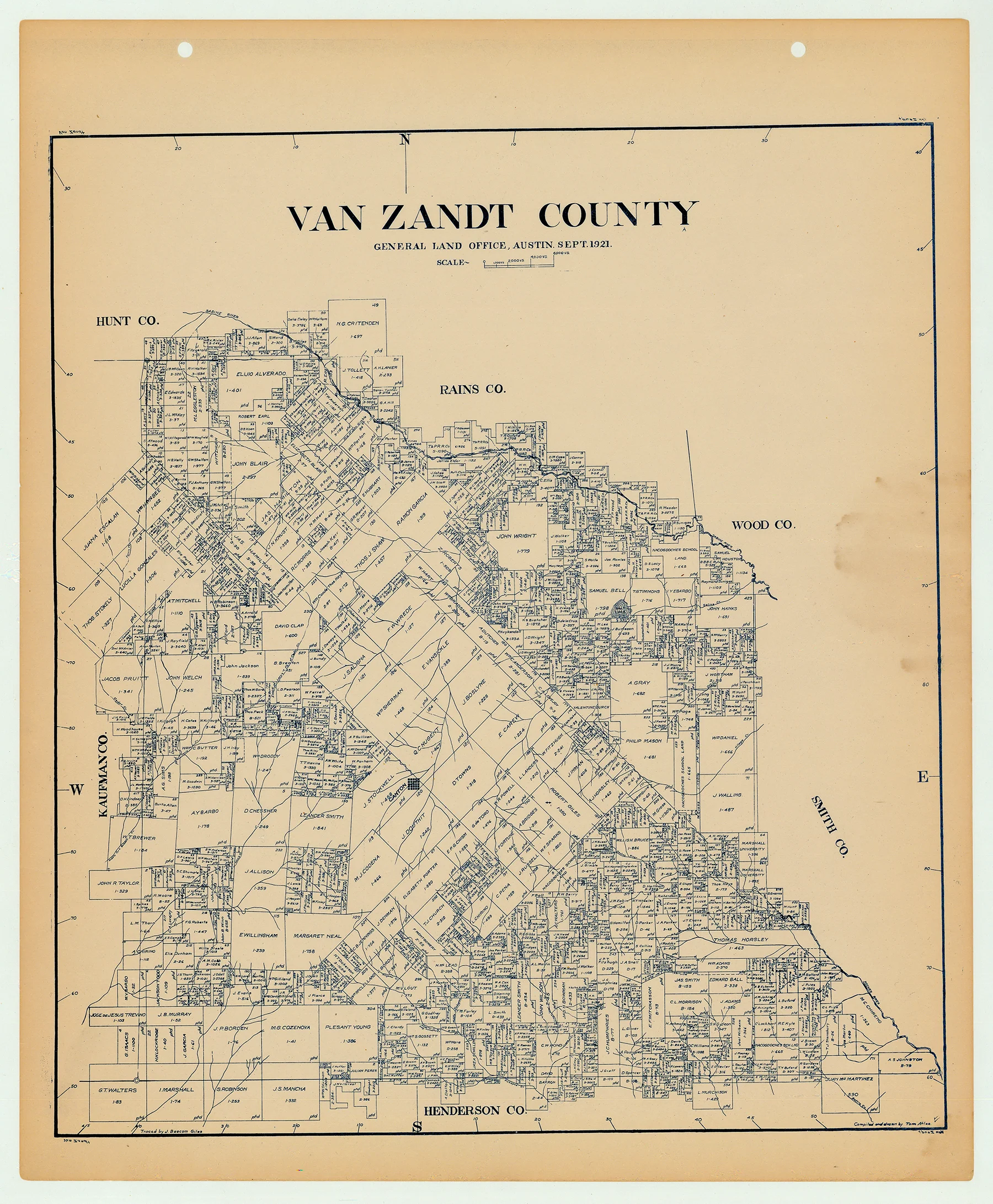
Description
- Title: Van Zandt Co.
- Author: Texas General Land Office
- Date: ca. 1925
- Medium: Lithograph
- Condition: Excellent
- Inches: 14 x 17 [Paper]
- Centimeters: 35.56 x 43.18 [Paper]
- Product ID: 3112219
Antique Texas county map published ca. 1925 by Wolf & Bennett for the Texas General Land Office. General Land Office maps show land patents, block and tract numbers, landowners, towns, railroads, and portions of adjacent counties where property boundaries extend beyond county limits.
This map shows Van Zandt County, est. 1921. The county seat of Canton is shown at center. The northeastern border of the county is defined by the Sabine River, and the southeast by the Neches River. The county is bordered by Hunt, Rains, Wood, Smith, Henderson, and Kaufman counties.
Survey date – 1921
Condition Notes:
- Uniform age toning, a bit darker along edges, paper somewhat fragile, original binding holes present.
- Tidal marks on right edge, extending into image.
- Very good overall condition.


