
Henderson County - Texas General Land Office Map ca. 1926
- Title: Henderson Co.
- Author: Texas General Land Office
- Date: ca. 1925
- Medium: Lithograph
- Condition: Excellent
- Inches: 14 x 17 [Paper]
- Centimeters: 35.56 x 43.18 [Paper]
- Product ID: 3112122
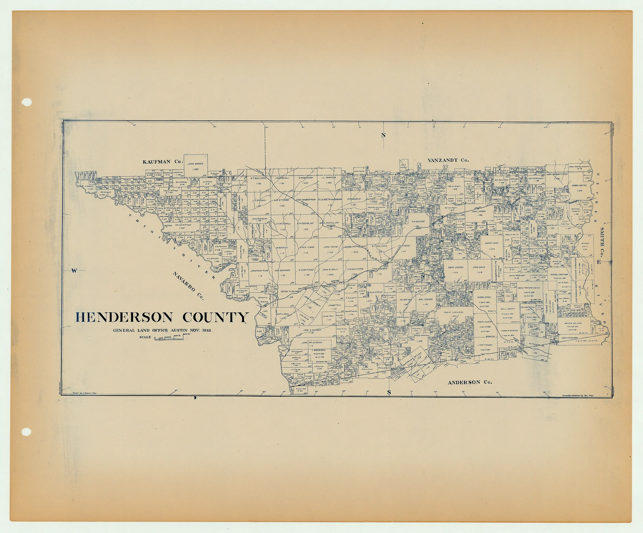
Antique Texas county map published ca. 1925 by Wolf & Bennett for the Texas General Land Office. General Land Office maps show land patents, block and tract numbers, landowners, towns, railroads, and portions of adjacent counties where property boundaries extend beyond county limits.
This map shows Henderson County, est. 1846. The county seat of Athens is shown near its center, on the junction of the Texas & New Orleans and St. Louis & Southwestern Railroads. The Trinity River forms the county’s western boundary with Navarro County, Kaufman, Van Zandt, Smith and Anderson counties border on the north, east, and south.
Survey date – 1922
Condition Notes:
- Uniform age toning, a bit darker along edges, paper somewhat fragile, original binding holes present.
- Excellent overall condition.
Description
- Title: Henderson Co.
- Author: Texas General Land Office
- Date: ca. 1925
- Medium: Lithograph
- Condition: Excellent
- Inches: 14 x 17 [Paper]
- Centimeters: 35.56 x 43.18 [Paper]
- Product ID: 3112122
Antique Texas county map published ca. 1925 by Wolf & Bennett for the Texas General Land Office. General Land Office maps show land patents, block and tract numbers, landowners, towns, railroads, and portions of adjacent counties where property boundaries extend beyond county limits.
This map shows Henderson County, est. 1846. The county seat of Athens is shown near its center, on the junction of the Texas & New Orleans and St. Louis & Southwestern Railroads. The Trinity River forms the county’s western boundary with Navarro County, Kaufman, Van Zandt, Smith and Anderson counties border on the north, east, and south.
Survey date – 1922
Condition Notes:
- Uniform age toning, a bit darker along edges, paper somewhat fragile, original binding holes present.
- Excellent overall condition.


