
Hartley County - Texas General Land Office Map ca. 1926
- Title: Hartley Co.
- Author: Texas General Land Office
- Date: ca. 1925
- Medium: Lithograph
- Condition: Excellent
- Inches: 14 x 17 [Paper]
- Centimeters: 35.56 x 43.18 [Paper]
- Product ID: 3112119
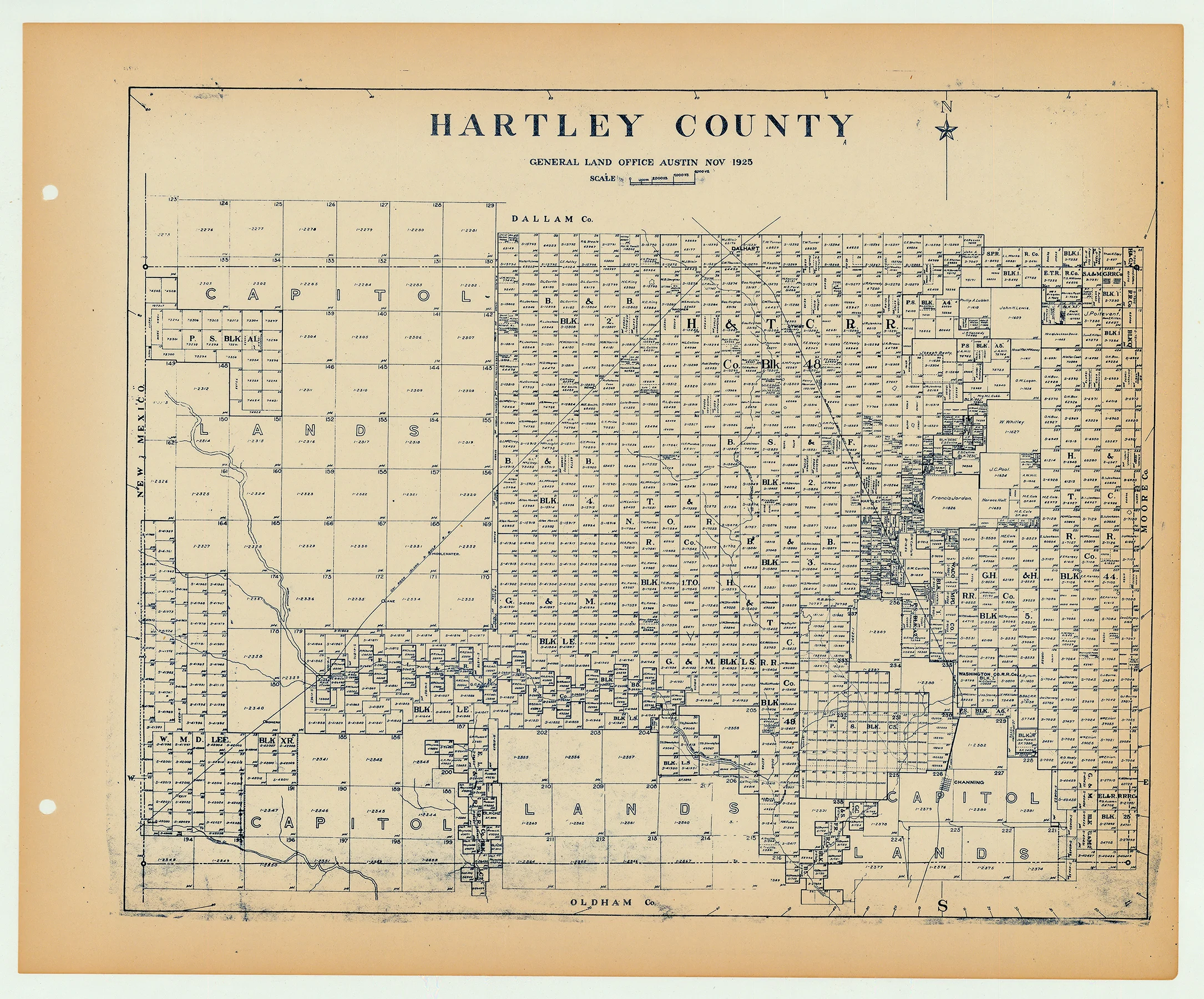
Antique Texas county map published ca. 1925 by Wolf & Bennett for the Texas General Land Office. General Land Office maps show land patents, block and tract numbers, landowners, towns, railroads, and portions of adjacent counties where property boundaries extend beyond county limits.
This map shows Hartley County, est. 1876. The county seat of Channing is shown at lower right, on the Ft. Worth & Denver City Railway. The Chicago, Rock Island & Gulf Railroad cuts diagonally from Dalhart in the north down into the southwest corner of the county. Hartley County is bordered by Dallam, Moore, and Oldham counties. New Mexico lies on its western border.
Survey date – 1925
Condition Notes:
- Uniform age toning, a bit darker along edges, paper somewhat fragile, original binding holes present.
- Excellent overall condition.
Description
- Title: Hartley Co.
- Author: Texas General Land Office
- Date: ca. 1925
- Medium: Lithograph
- Condition: Excellent
- Inches: 14 x 17 [Paper]
- Centimeters: 35.56 x 43.18 [Paper]
- Product ID: 3112119
Antique Texas county map published ca. 1925 by Wolf & Bennett for the Texas General Land Office. General Land Office maps show land patents, block and tract numbers, landowners, towns, railroads, and portions of adjacent counties where property boundaries extend beyond county limits.
This map shows Hartley County, est. 1876. The county seat of Channing is shown at lower right, on the Ft. Worth & Denver City Railway. The Chicago, Rock Island & Gulf Railroad cuts diagonally from Dalhart in the north down into the southwest corner of the county. Hartley County is bordered by Dallam, Moore, and Oldham counties. New Mexico lies on its western border.
Survey date – 1925
Condition Notes:
- Uniform age toning, a bit darker along edges, paper somewhat fragile, original binding holes present.
- Excellent overall condition.


