
Guadalupe County - Texas General Land Office Map ca. 1925
- Title: Guadalupe Co.
- Author: Texas General Land Office
- Date: ca. 1925
- Medium: Lithograph
- Condition: Excellent
- Inches: 14 x 17 [Paper]
- Centimeters: 35.56 x 43.18 [Paper]
- Product ID: 3112111
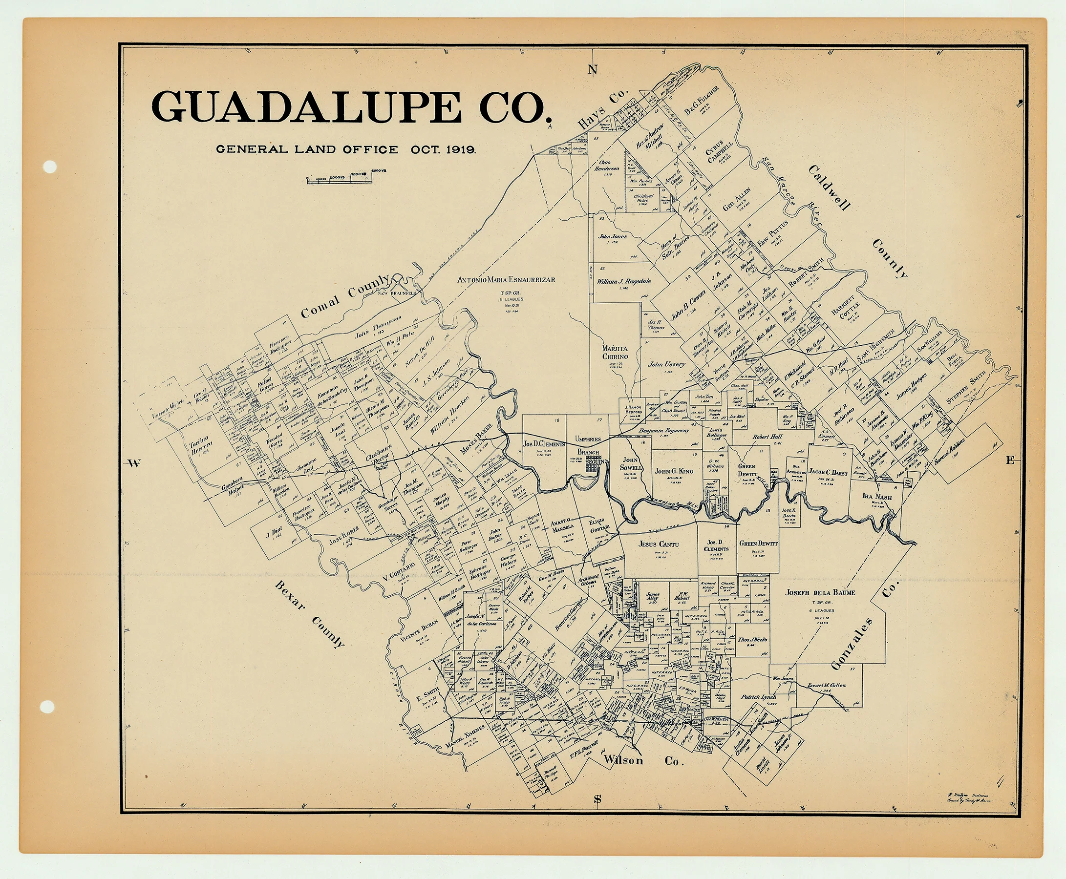
Antique Texas county map published ca. 1925 by Wolf & Bennett for the Texas General Land Office. General Land Office maps show land patents, block and tract numbers, landowners, towns, railroads, and portions of adjacent counties where property boundaries extend beyond county limits.
This map shows Guadalupe County, est. 1846. The county seat of Seguin is shown near its center, on the banks of the Guadalupe River. The town is located just south of the Galveston, Harrisburg, and San Antonio Railway, which traverses the county from east to west. The county is bordered by Comal, Caldwell, Gonzales, and Bexar counties.
Survey date – 1919
Condition Notes:
- Uniform age toning, a bit darker along edges, paper somewhat fragile, original binding holes present.
- Excellent overall condition.
Description
- Title: Guadalupe Co.
- Author: Texas General Land Office
- Date: ca. 1925
- Medium: Lithograph
- Condition: Excellent
- Inches: 14 x 17 [Paper]
- Centimeters: 35.56 x 43.18 [Paper]
- Product ID: 3112111
Antique Texas county map published ca. 1925 by Wolf & Bennett for the Texas General Land Office. General Land Office maps show land patents, block and tract numbers, landowners, towns, railroads, and portions of adjacent counties where property boundaries extend beyond county limits.
This map shows Guadalupe County, est. 1846. The county seat of Seguin is shown near its center, on the banks of the Guadalupe River. The town is located just south of the Galveston, Harrisburg, and San Antonio Railway, which traverses the county from east to west. The county is bordered by Comal, Caldwell, Gonzales, and Bexar counties.
Survey date – 1919
Condition Notes:
- Uniform age toning, a bit darker along edges, paper somewhat fragile, original binding holes present.
- Excellent overall condition.


