✨ New Arrivals Just Dropped!Explore

Detail of Cities and Towns in Galveston County Texas: Texas State Highway Department 1974
- Title: Detail of Cities and Towns in Galveston County Texas
- Author: Texas State Highway Department
- Date: 1974
- Medium: Printed color
- Condition: Good - age toning and foxing, paper loss in corners, discoloration to left of image - On sheet with remainder of Galveston Island condition good, some chipping, mild age toning
- Inches: 25 x 18 [Paper]
- Centimeters: 63.5 x 45.72 [Paper]
- Product ID: 318055
General Highway Map
Supplementary Sheet
Showing
Detail of Cities and Towns
in
Galveston County Texas
Prepared by the
Texas State Highway Department
Planning and Research Division
in Cooperation with the
U. S. Department of Transportation
Federal Highway Administration
1968
1970 Census Figures
Highways Revised to January 1, 1974
Map of Galveston Island, Texas including part of Galveston Bay, Pelican Island, and Bolivar Peninsula. A legend marks sites and establishments in the area such as dwellings, businesses, post offices, schools, factories, churches, hospital, oil wells, highways, bridges, and many others. Map shows rail routes, highways, street names, beaches, and piers on the island.
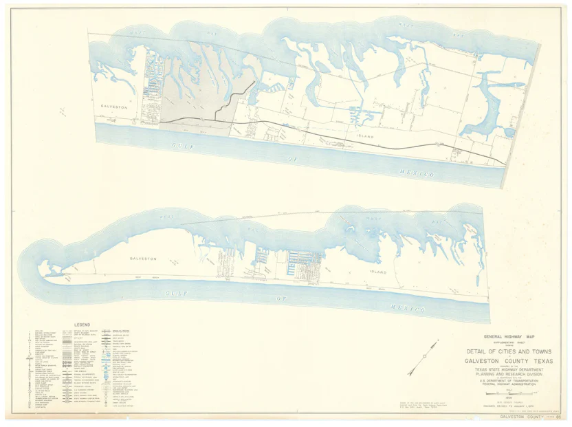
Map sold as set in two separate sheets with remainder of Galveston Island on verso .
$208.25
Original: $595.00
-65%Detail of Cities and Towns in Galveston County Texas: Texas State Highway Department 1974—
$595.00
$208.25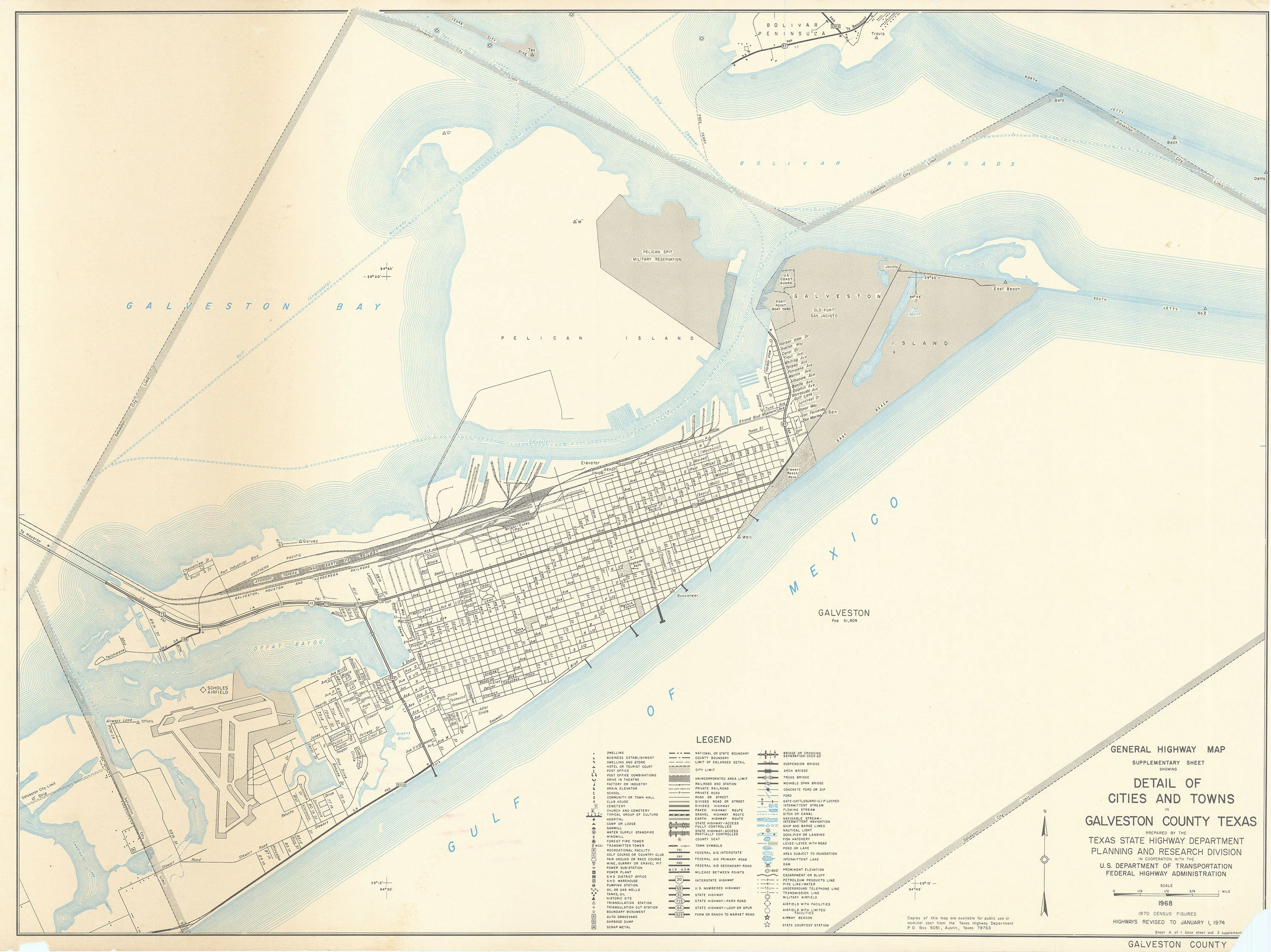
Description
- Title: Detail of Cities and Towns in Galveston County Texas
- Author: Texas State Highway Department
- Date: 1974
- Medium: Printed color
- Condition: Good - age toning and foxing, paper loss in corners, discoloration to left of image - On sheet with remainder of Galveston Island condition good, some chipping, mild age toning
- Inches: 25 x 18 [Paper]
- Centimeters: 63.5 x 45.72 [Paper]
- Product ID: 318055
General Highway Map
Supplementary Sheet
Showing
Detail of Cities and Towns
in
Galveston County Texas
Prepared by the
Texas State Highway Department
Planning and Research Division
in Cooperation with the
U. S. Department of Transportation
Federal Highway Administration
1968
1970 Census Figures
Highways Revised to January 1, 1974
Map of Galveston Island, Texas including part of Galveston Bay, Pelican Island, and Bolivar Peninsula. A legend marks sites and establishments in the area such as dwellings, businesses, post offices, schools, factories, churches, hospital, oil wells, highways, bridges, and many others. Map shows rail routes, highways, street names, beaches, and piers on the island.
Map sold as set in two separate sheets with remainder of Galveston Island on verso .


