✨ New Arrivals Just Dropped!Explore

County Map of Kansas, Nebraska, Dakota, and Minnesota: Warner & Beers 1873
-
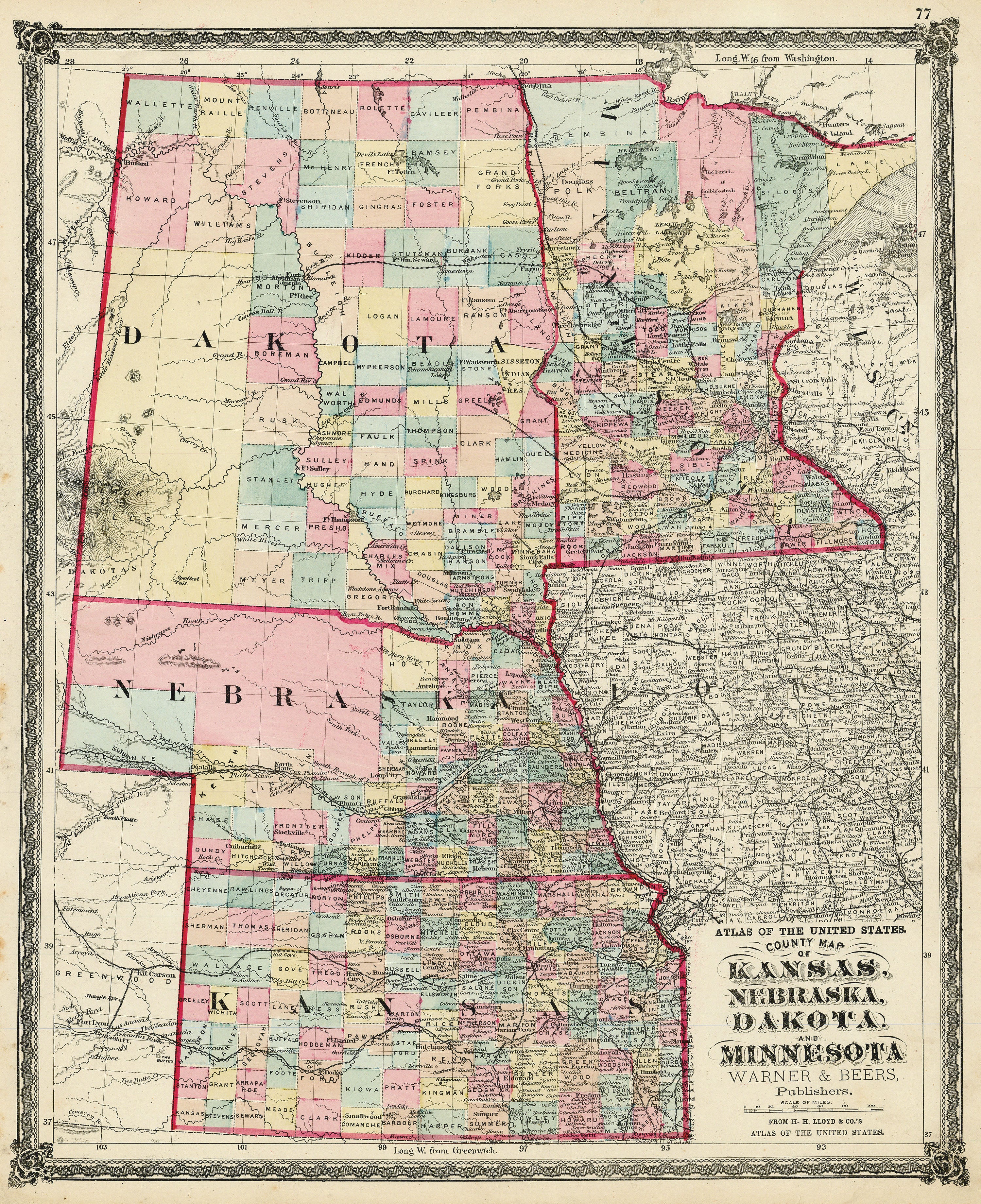
Title: County Map of Kansas, Nebraska, Dakota, and Minnesota
- Author: Warner & Beers
- Date: 1873
- Medium: Hand-colored lithograph
- Condition: Very Good Plus - light age toning, marginal paper loss
- Inches: 15 1/2 x 18 1/2 [Paper]
- Centimeters: 39.37 x 46.99 [Paper]
- Product ID: 3110000
Map of Kansas, Nebraska, Minnesota, and Dakota Territory. Also shows parts of Iowa, Wisconsin, Canada, Wyoming, and Montana
$110.00
County Map of Kansas, Nebraska, Dakota, and Minnesota: Warner & Beers 1873—
$110.00
Description
-
Title: County Map of Kansas, Nebraska, Dakota, and Minnesota
- Author: Warner & Beers
- Date: 1873
- Medium: Hand-colored lithograph
- Condition: Very Good Plus - light age toning, marginal paper loss
- Inches: 15 1/2 x 18 1/2 [Paper]
- Centimeters: 39.37 x 46.99 [Paper]
- Product ID: 3110000
Map of Kansas, Nebraska, Minnesota, and Dakota Territory. Also shows parts of Iowa, Wisconsin, Canada, Wyoming, and Montana


