
Cass County - Texas General Land Office Map ca. 1926
- Title: Cass Co.
- Author: Texas General Land Office
- Date: ca. 1925
- Medium: Lithograph
- Condition: Excellent
- Inches: 14 x 17 [Paper]
- Centimeters: 35.56 x 43.18 [Paper]
- Product ID: 3112068
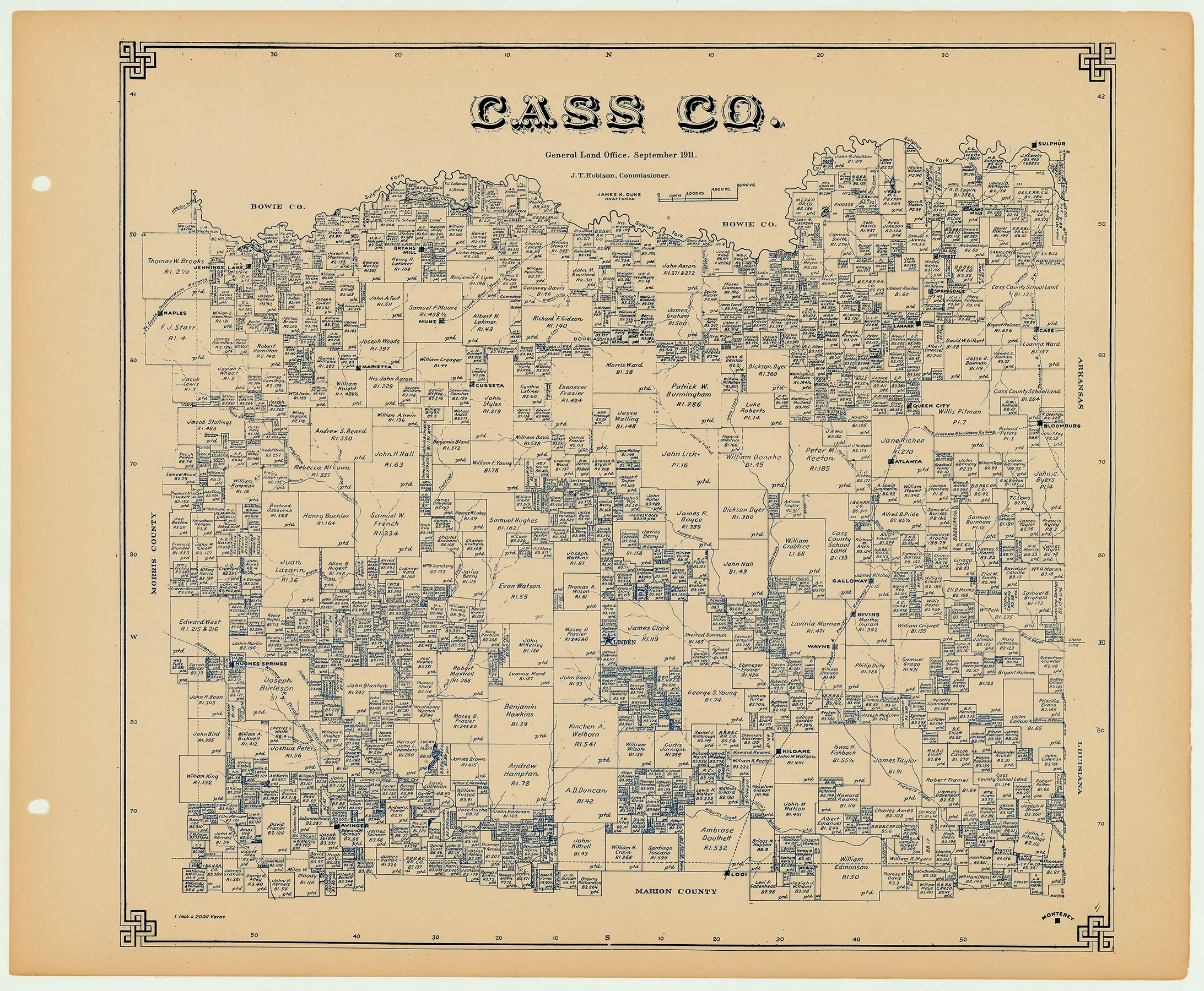
Antique Texas county map published ca. 1925 by Wolf & Bennett for the Texas General Land Office. General Land Office maps show land patents, block and tract numbers, landowners, towns, railroads, and portions of adjacent counties where property boundaries extend beyond county limits.
This map of Cass County shows the county seat of Linden at its center. Several rail lines are represented in the county, including the Texas Arkansas & Louisiana Railway, Texas & Pacific Railway, Northeast Texas Railway, St. Louis Southwestern Railway, and the Missouri, Kansas & Texas Railway. Also shown are the surrounding Bowie, Morris and Marion counties, as well as the borders with Arkansas and Louisiana.
Survey date – 1911
Condition Notes:
- Uniform age toning, a bit darker along edges, paper somewhat fragile, original binding holes present.
- Excellent overall condition.
Description
- Title: Cass Co.
- Author: Texas General Land Office
- Date: ca. 1925
- Medium: Lithograph
- Condition: Excellent
- Inches: 14 x 17 [Paper]
- Centimeters: 35.56 x 43.18 [Paper]
- Product ID: 3112068
Antique Texas county map published ca. 1925 by Wolf & Bennett for the Texas General Land Office. General Land Office maps show land patents, block and tract numbers, landowners, towns, railroads, and portions of adjacent counties where property boundaries extend beyond county limits.
This map of Cass County shows the county seat of Linden at its center. Several rail lines are represented in the county, including the Texas Arkansas & Louisiana Railway, Texas & Pacific Railway, Northeast Texas Railway, St. Louis Southwestern Railway, and the Missouri, Kansas & Texas Railway. Also shown are the surrounding Bowie, Morris and Marion counties, as well as the borders with Arkansas and Louisiana.
Survey date – 1911
Condition Notes:
- Uniform age toning, a bit darker along edges, paper somewhat fragile, original binding holes present.
- Excellent overall condition.


