
Brewster County (South) - Texas General Land Office Map ca. 1925
- Title: Brewster Co. – South Part
- Author: Texas General Land Office
- Date: ca. 1925
- Medium: Lithograph
- Condition: Excellent
- Inches: 14 x 17 [Paper]
- Centimeters: 35.56 x 43.18 [Paper]
- Product ID: 3112059
Antique Texas county map published ca. 1925 by Wolf & Bennett for the Texas General Land Office. General Land Office maps show land patents, block and tract numbers, landowners, towns, railroads, and portions of adjacent counties where property boundaries extend beyond county limits.
This map of Brewster County – South Part shows the dense concentration of railroad company holdings. Also shown are neighboring Presidio County and the Big Bend region of the Rio Grande River border with Mexico.
Survey date – 1914
Condition Notes:
- Uniform age toning, a bit darker along edges, paper somewhat fragile, original binding holes present.
- Tears in edges of paper, outside of image
- Excellent overall condition.
Original: $200.00
-65%$200.00
$70.00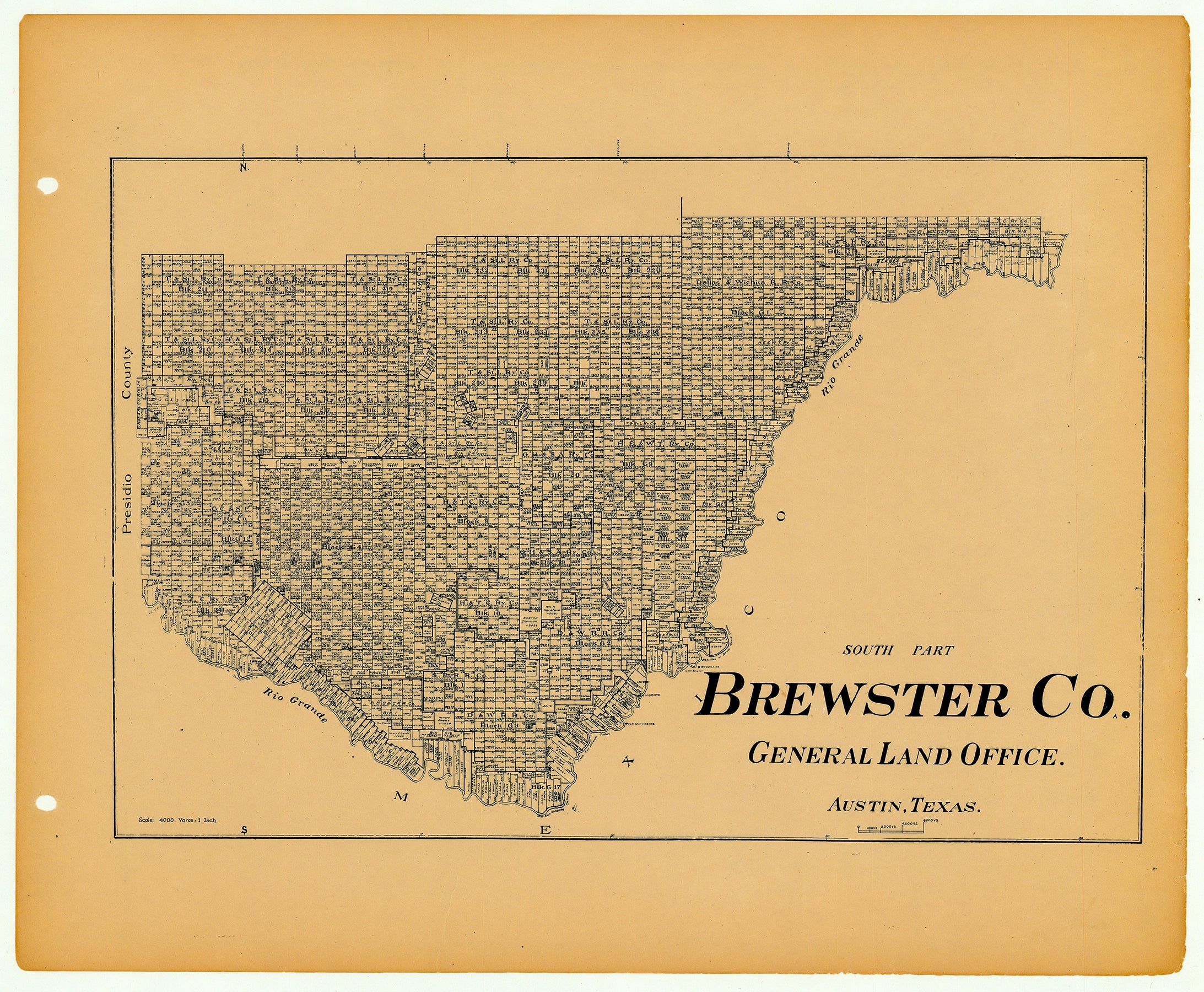
Description
- Title: Brewster Co. – South Part
- Author: Texas General Land Office
- Date: ca. 1925
- Medium: Lithograph
- Condition: Excellent
- Inches: 14 x 17 [Paper]
- Centimeters: 35.56 x 43.18 [Paper]
- Product ID: 3112059
Antique Texas county map published ca. 1925 by Wolf & Bennett for the Texas General Land Office. General Land Office maps show land patents, block and tract numbers, landowners, towns, railroads, and portions of adjacent counties where property boundaries extend beyond county limits.
This map of Brewster County – South Part shows the dense concentration of railroad company holdings. Also shown are neighboring Presidio County and the Big Bend region of the Rio Grande River border with Mexico.
Survey date – 1914
Condition Notes:
- Uniform age toning, a bit darker along edges, paper somewhat fragile, original binding holes present.
- Tears in edges of paper, outside of image
- Excellent overall condition.


