
Brazoria County - Texas General Land Office Map ca. 1925
- Title: Brazoria Co.
- Author: Texas General Land Office
- Date: ca. 1925
- Medium: Lithograph
- Condition: Very Good Plus - age toning, cellophane tape stain lower right
- Inches: 14 x 17 [Paper]
- Centimeters: 35.56 x 43.18 [Paper]
- Product ID: 3110049
Antique Texas county map, published ca. 1925 by Wolf & Bennett for the Texas General Land Office. General Land Office maps show land patents, block and tract numbers, landowners, towns, railroads, and portions of adjacent counties where property boundaries extend beyond county limits.
This map of Brazoria County shows the cities of Angleton and Alvin, the Gulf of Mexico coastline, and numerous landholdings of Stephen F. Austin. Also shown are the surrounding counties of Fort Bend, Harris, and Matagorda, as well as portions of the St. Louis, Brownsville & Mexico Railway, International & Great Northern Railroad, and Gulf, Colorado and Santa Fe Railroad.
Survey date - 1918
Original: $250.00
-65%$250.00
$87.50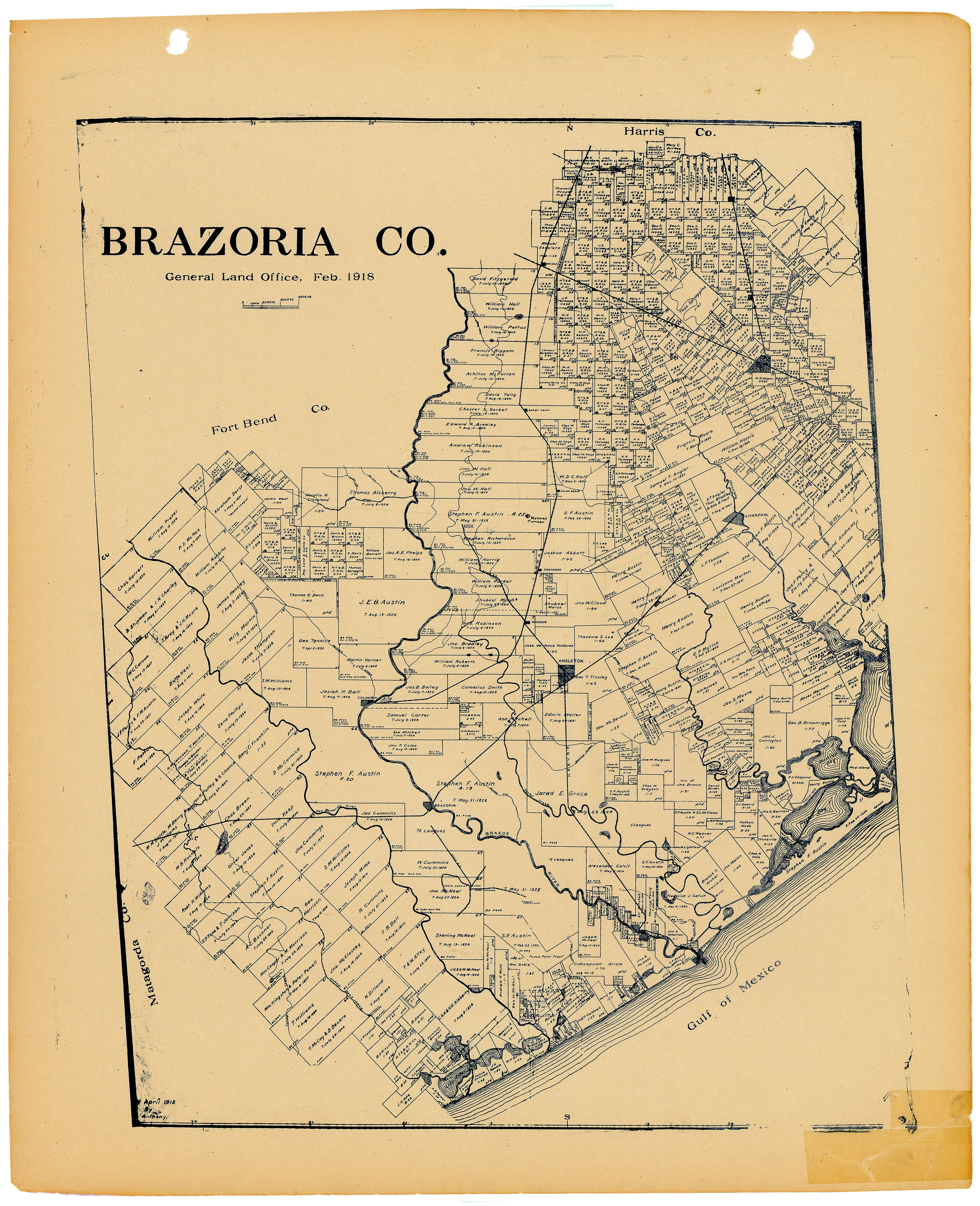
Description
- Title: Brazoria Co.
- Author: Texas General Land Office
- Date: ca. 1925
- Medium: Lithograph
- Condition: Very Good Plus - age toning, cellophane tape stain lower right
- Inches: 14 x 17 [Paper]
- Centimeters: 35.56 x 43.18 [Paper]
- Product ID: 3110049
Antique Texas county map, published ca. 1925 by Wolf & Bennett for the Texas General Land Office. General Land Office maps show land patents, block and tract numbers, landowners, towns, railroads, and portions of adjacent counties where property boundaries extend beyond county limits.
This map of Brazoria County shows the cities of Angleton and Alvin, the Gulf of Mexico coastline, and numerous landholdings of Stephen F. Austin. Also shown are the surrounding counties of Fort Bend, Harris, and Matagorda, as well as portions of the St. Louis, Brownsville & Mexico Railway, International & Great Northern Railroad, and Gulf, Colorado and Santa Fe Railroad.
Survey date - 1918


